MAPA SS4A Data Support Plan (RFQ)
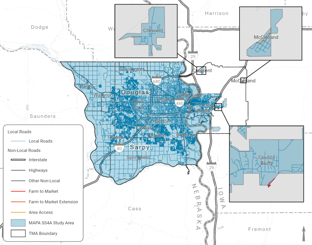
BackThe Omaha-Council Bluffs Metropolitan Area Planning Agency (MAPA) is soliciting qualifications to develop a Comprehensive Safety Action Plan (CSAP) for the MAPA Safe Streets and Roads for All (SS4A) Study Area (Figure 1) with a substantial Public Outreach component.
In accordance with USC 2 CFR 200, Nebraska Consultants’ Competitive Negotiation Act (Neb. Rev. Stat. §81-1712), the Brooks Act (40 USC 544), and 23 CFR 172.5, MAPA is issuing a Request for Qualifications (RFQ) for the SS4A Data Support Plan. This Data Support plan will support efforts in the development of MAPA’s Regional CSAP, which will build on MAPA’s current safety planning efforts to achieve zero deaths by 2040. The CSAP will prioritize strategies that maximize opportunities for discretionary funding to implement local roadway projects in rural and disadvantaged communities. The MAPA website referred to in this document is located at http://mapacog.org/projects/ss4a/
Figure 1. MAPA SS4A Study Area and Associated Local Road Network (https://arcg.is/1SavCf)
This MAPA SS4A Data Support Plan project will be closely coordinated with the MAPA SS4A Public Outreach and CSAP project. This project will develop robust, repeatable, data preparation, analysis and reporting processes of traffic safety and impacted community data. Crashes on all public roadways, regardless of ownership, will be included for the entire MAPA Transportation Management Area (TMA), with the ability to subset data to local roads for the communities defined within the MAPA SS4A Study Area for safety project development and implementation.
Applicants are permitted to submit separate proposals for one or more of the posted MAPA SS4A projects.
The Request for Qualifications (RFQ) is now closed. The RFQ and related documentation are available below for informational purposes.
Answers to Questions Received (09/22/2023)
Respondent Shortlist (11/02/2023)