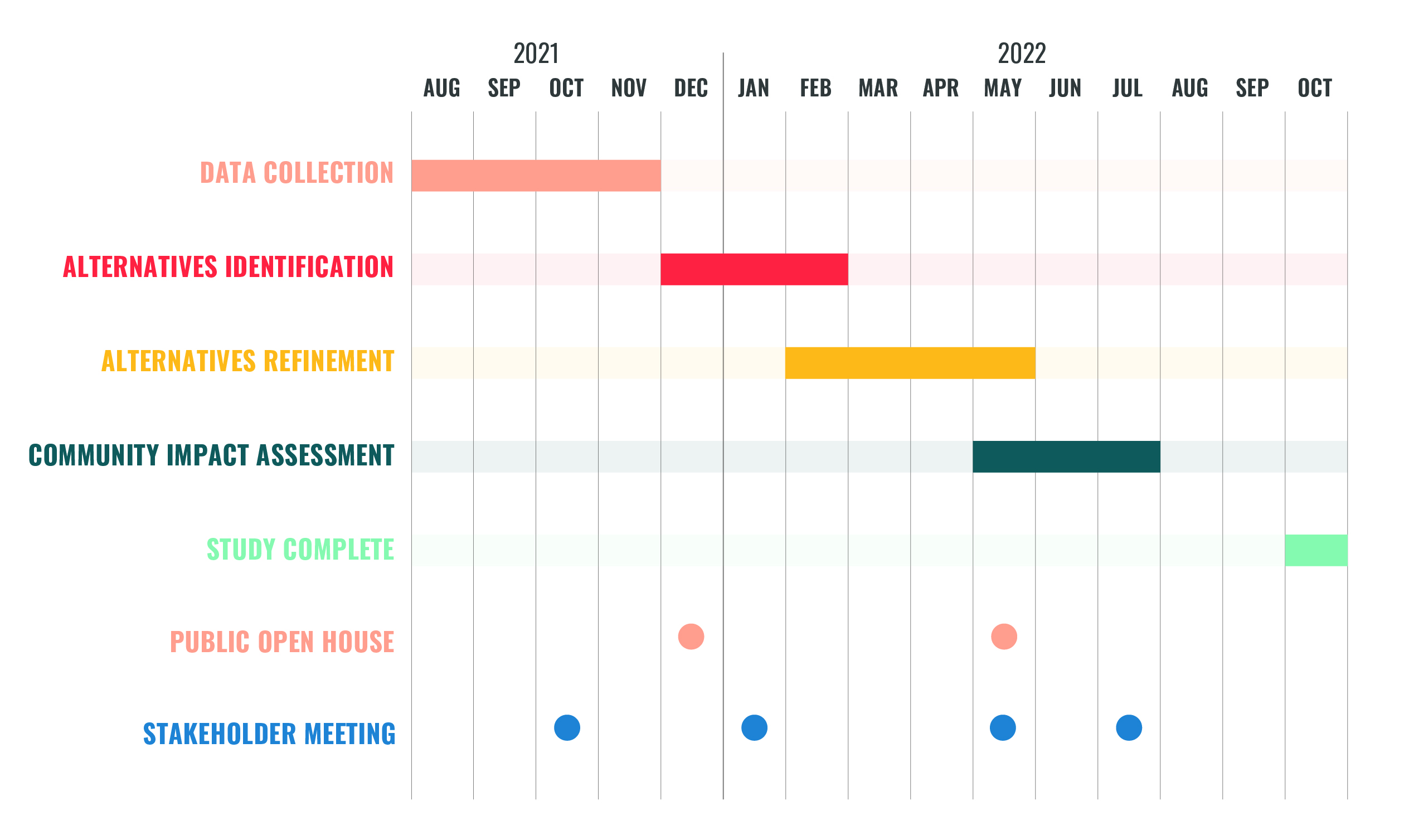
The Omaha-Council Bluffs Metropolitan Area Planning Agency (MAPA) has completed the Highway 75 Corridor & Freight Strategy Study.

Since the mid-1950s, there has been a long history of investigating potential alignments of the U.S. Highway 75 corridor. Most recently, there has been continued interest in addressing the need for an improved connection between the North Freeway, the Storz Expressway, and I-680, while also mitigating the community impacts of the current Highway 75 alignment along 30th Street. In 2019, the Nebraska Legislature approved funds for MAPA to conduct a study that will assess potential transportation and economic options in the study area.

The Highway 75 Corridor & Freight Strategy study is a high-level analysis that will identify feasible, planning-level concepts that meet study mobility, safety, and community goals. This study will provide a unique opportunity for residents, businesses, and the wider Omaha-Council Bluffs metro area to identify transportation alternatives that meet a variety of needs, including mobility, safety, accessibility, the movement of freight, economics, and neighborhood livability. Highway 75, which is also known as 30th Street within the study area, is an important component of Omaha’s transportation network that moves thousands of vehicles each day. In addition to moving passenger and commuter traffic, this stretch of highway also is a crucial conduit for thousands of tons of freight as it moves in, out, and through the Omaha metro area.

Study Area

Project Schedule

The study kicked off in August 2021 with a data collection phase, which included a land use review, traffic and safety analysis, and environmental and historic resources review. The study will then transition to an alternatives identification, development, and refinement phase. This phase will also include a feasibility and community impact assessment. Stakeholder and public insight is and will continue to be a critical component for guiding the study team through this process.


Frequently Asked Questions

What activities are included in this study?
A wide variety of activities will be undertaken in this study, including data collection, mobility and safety analysis, development and refinement of potential alternatives, freight assessment, environmental reviews, assessments of social benefits and impacts, economic analyses, community impact assessments, and public and stakeholder engagement.

Will improvements to 30th Street be included in this study?
This study will consider a variety of improvements to 30th Street, including accessibility for bicyclists and pedestrians, improved transit service, pedestrian and vehicle safety improvements, and enhanced landscaping and beautification.

How are conceptual alternatives evaluated?
In this study process, improvement alternatives will be evaluated through a two-level screening process. First, a variety of potential alternatives will be identified and screened with consideration for bicycle and pedestrian connections and safety, vehicular traffic operations, safety, freight, environmental conditions, equity, and stakeholder/public feedback. Then, the second screening will refine the alternatives in deeper detail and evaluate them using a cost/benefit analysis, community impact assessment, and stakeholder/public feedback.

Why is MAPA conducting this study?
In 2019, the Nebraska Legislature approved funds for MAPA to conduct a feasibility study for Highway 75 to assess transportation and economic options in the area. This study was also included as a recommendation in the Metropolitan Area Travel Improvement Study that MAPA conducted in 2017.

What happens after the study?
The study’s next steps depend on the feasibility of alternatives that result from the study. If feasible alternatives are identified, they would require further study of benefits and impacts, as well as more detailed engineering, conditional on funding availability.


Contact Us

Court Barber
MAPA Transportation Planner
402-444-6866 x3219
cbarber@mapacog

General Comment Form